What the Kumano Kodo Is
The Kumano Kodo is the network of pilgrimage trails that crosses the Kii mountains, walked for centuries by pilgrims bound for the three grand shrines of Kumano — Hongu, Hayatama and Nachi Taisha, known together as the Kumano Sanzan. In 2004 the trails and shrines were inscribed by UNESCO as the Sacred Sites and Pilgrimage Routes in the Kii Mountain Range.
These are working sacred routes, not a theme trail: the paths end at shrines where worship continues daily, and at Nachi the object of worship is the 133 m waterfall itself. Walk them with that in mind and the experience organizes itself.
The Accessible Taste: Daimon-zaka
Daimon-zaka is the final approach of the Nakahechi route to Nachi-san: a roughly 600-meter stone-paved slope climbing between cedars that have stood for centuries. It takes about 30–40 minutes uphill at a respectful pace — long enough to feel like an arrival, short enough for anyone in ordinary shoes with decent grip. It is the best half-day Kumano Kodo experience that exists without committing to a trek.
The half-day route
- Bus to the Daimon-zaka stop. From Kii-Katsuura station the bus toward Nachi-san takes under 30 minutes to this stop (¥420–620 by stop, as of mid-2026) — full details in the getting-there guide.
- Walk the slope. 30–40 minutes up the stone paving under the cedars. This is the walk — unhurried is the correct speed.
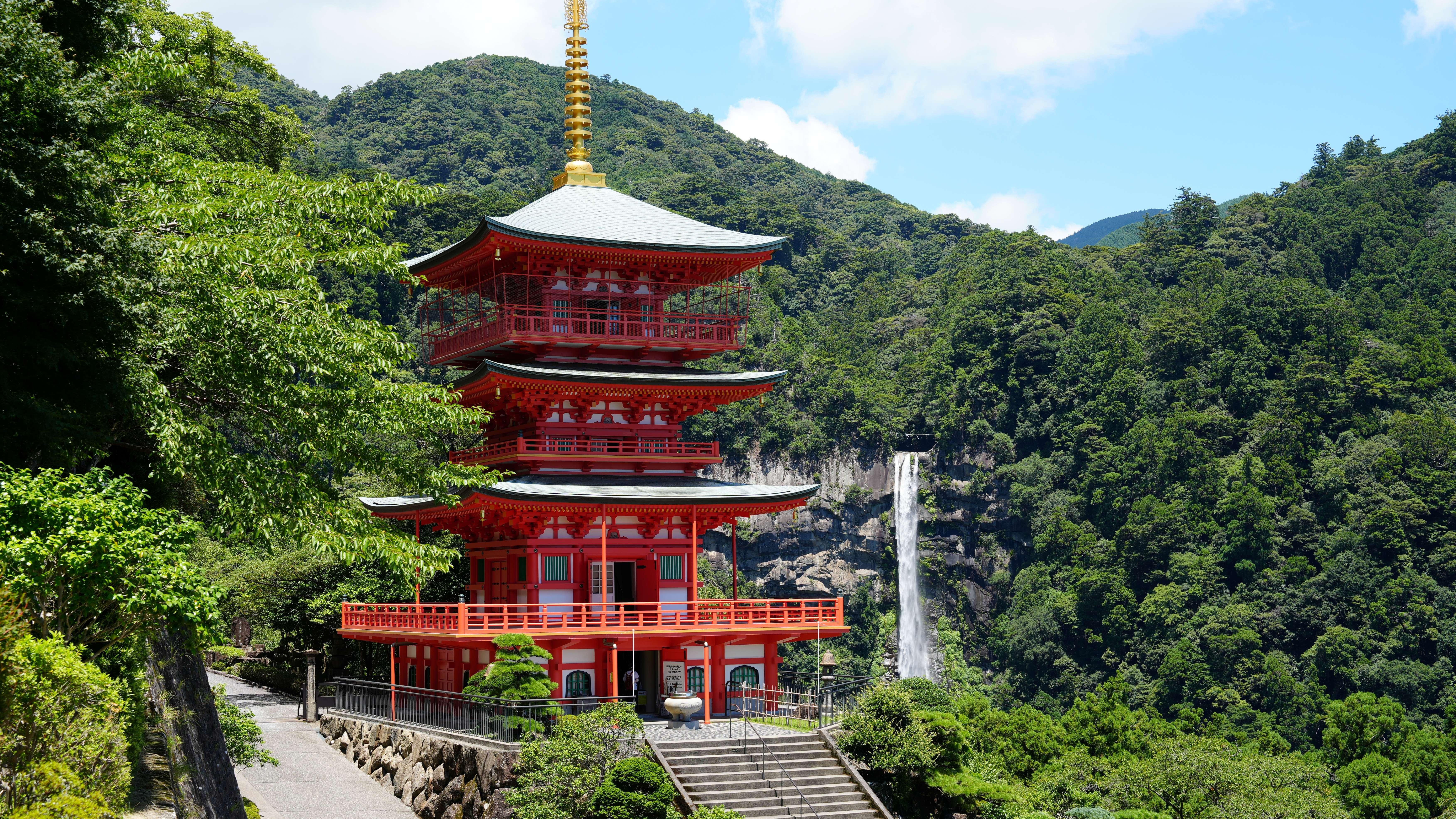
- Visit the precinct at the top. Kumano Nachi Taisha, the grand shrine, sits up a long stone stairway (about 467 steps are commonly cited) — and directly beside it, the Tendai temple Seiganto-ji with its three-story pagoda, the vantage point for the famous pagoda-and-falls photograph.
- Descend to the falls. The approach to Hirou-jinja at the base of the falls is free; the closest viewing platform is ¥300 (as of mid-2026).
- Bus back from the top. Catch the return bus from the Nachi-no-Taki-mae stop by the falls — no need to retrace the slope.
The Real Thing: Walking the Nakahechi
The Nakahechi is the classic multi-day route of the Kumano Kodo, crossing the mountains shrine to shrine over several days. Walkers traditionally finish at Nachi — which means the Daimon-zaka slope and the falls are not a consolation prize; they are the destination the whole route builds toward.
A multi-day walk needs real planning — lodging along the trail, luggage arrangements, daily distances matched to your legs. That planning is beyond a day-hike page, and the official Kumano tourism resources cover it properly; start there rather than improvising. What this page can tell you is what waits at the end.
The Guided Middle Path
Between the half-day slope and the multi-day trek sits one option rail cannot match: a guided day from Osaka that reaches all three grand shrines in a single day, including the world’s largest torii gate at Oyunohara and a walk on the Daimon-zaka pilgrim route at Nachi. As of our last check, exactly two bookable tours put Nachi Falls on a named itinerary — this is the scheduled group one, and its route is essentially the Kumano Sanzan in miniature.
Walk It With a Guide
UNESCO Kumano Kodo: Complete 3 Grand Shrines & Nachi Hike
From Osaka: a walk on the Daimon-zaka pilgrim route, Nachi Taisha, Seiganto-ji and the falls — plus Hongu, Hayatama and the Oyunohara torii, all in one day. Guaranteed departures, free cancellation.
Every bookable option is compared in the tours and prices section.
Kumano Kodo Day Hike FAQ
The practical questions, answered before you lace up.
You can walk a genuine piece of it in half a day. Daimon-zaka — the roughly 600-meter, stone-paved, cedar-lined slope up to Nachi-san — is part of the Nakahechi pilgrimage route and takes about 30–40 minutes uphill. Combined with the shrine, temple and falls at the top, it makes a full and honest half-day. How to reach the trailhead by train and bus is covered in the getting-there guide.
It is a steady uphill on centuries-old stone paving — roughly 600 meters, about 30–40 minutes at an unhurried pace. It is not a trek and needs no special gear, but the stones deserve respect, especially when wet. The trailhead bus stop and the route up are plotted on the Nachi area map.
The Nakahechi is the classic route of the Kumano Kodo, the pilgrimage trail network of the Kii mountains, UNESCO-listed since 2004. Multi-day walkers cross the mountains between the three grand shrines and traditionally finish at Nachi. What those three shrines are and how they relate is explained in the Kumano Sanzan guide.
Not for Daimon-zaka — it is well marked, short and reached by public bus, so it works fine self-guided. A guided day tour earns its keep if you want all three grand shrines in one day, which no rail-and-bus combination manages. If you are doing it independently, basing in the port town below makes the early start easy — see the Kii-Katsuura guide.
Shoes with grip and water — the stone paving can be slick after rain, and the Kii coast gets plenty of it. Rain also happens to be when the falls run fullest, so a wet forecast is not a reason to cancel. What each season does to the walk and the falls is in the seasons guide.
Up. Take the bus to the Daimon-zaka stop, climb the cedar-lined slope the way pilgrims arrived for centuries, and let the shrine precinct open above you. At the top you visit Kumano Nachi Taisha, the temple beside it and the falls, then catch the bus back down from the top — no need to retrace the slope.